A relaxed self-drive loop in Curaçao linking viewpoints, coastal walks and snack stops. Clear directions, parking tips and low-effort nature stops.
In this guide
- Scenic Curaçao in One Easy Driving Loop
- How to Use This Loop
- Drive Segment 1: Willemstad to Sint Michiel & Bullenbaai
- Drive Segment 2: Inland via Tera Kòrá to Barber
- Barber: Shade, Short Walks & More Snacks
- Drive Segment 3: Shete Boka North Coast Cliffs
- Drive Segment 4: West Coast Detours – Cliffs & Coves
- Drive Segment 5: Salt Flats & Flamingo Views
- Drive Segment 6: Coastal Views Back Toward Willemstad
- Optional Short Walk Add-Ons
- Good to know
- FAQ
Scenic Curaçao in One Easy Driving Loop
Curaçao isn’t just beaches and resorts. With a rental car and a loose plan, you can see cliffs, salt flats, old plantations, windblown north coast views and a few hidden coves — without committing to long hikes.
This loop is designed as a flexible day out starting anywhere around Willemstad. You can drive it clockwise or anticlockwise, stop where you like, and skip anything that doesn’t appeal.
How to Use This Loop
- You can do the full loop in a relaxed 6–9 hours with stops.
- Roads are mostly paved and fine for small cars; no 4x4 needed if you stay on the main routes.
- Phone maps work well, but save offline maps in case your signal drops in rural spots.
- Watch your fuel level; top up around Willemstad or Barber before heading further west.
The loop is described clockwise, starting from the Willemstad area and heading west.
Drive Segment 1: Willemstad to Sint Michiel & Bullenbaai
From central Willemstad, head west following signs for Otrobanda and then the road toward Bullenbaai / the western districts. You’ll leave the city fairly quickly and pass suburban areas and industrial zones before the views start to open up.
Sint Michiel Lookout & Lagoon
Best for: Casual photos, bird spotting, short leg-stretcher
Pull off near Sint Michiel (Boca Sami) where the road gives you quick views over the lagoon and old salt pans.
-
What to do:
- Park safely off the main road wherever there is a proper lay-by or wider shoulder.
- Take a few minutes to look for flamingos and other wading birds in the distance; sightings depend on water level and season.
- If you want a quick walk, take one of the dirt tracks edging the lagoon for 10–15 minutes and then back.
-
Parking realities:
- It is roadside and informal — don’t block driveways or narrow curves.
- Keep valuables out of sight and lock the car if you wander off.
Continue west along the main road toward Bullenbaai and then follow signs for Tera Kòrá / Barber.
Drive Segment 2: Inland via Tera Kòrá to Barber
The central road west is straightforward: one main paved road with roundabouts and intersections signed for several villages and beaches.
Plantation Landscape & Roadside Snacks (Tera Kòrá Area)
Best for: Roadside eats, local feel, quick views**
As you pass Tera Kòrá and nearby villages, the scenery shifts to dry hills dotted with cactus, divi-divi trees and old plantation structures.
-
Roadside snacks:
- Keep an eye out for small snack shacks and food trucks around crossroads and gas stations.
- Typical easy bites include pastechi (stuffed pastries), johnny cakes, grilled chicken, and cold drinks.
- Don’t expect menus; point, ask what’s good, and bring small cash.
-
Parking realities:
- Park only where you’re clearly off the traffic lane.
- In small villages, ask a vendor if you’re okay to leave the car where you’ve stopped; people are usually helpful.
Continue toward Barber, the main inland village before the west coast.
Barber: Shade, Short Walks & More Snacks
Barber Village & Church Area
Best for: Coffee/snack break, local color, very short wanders
Barber is a handy halfway pause before you hit the western coast.
-
What to do:
- Walk a quick loop around the central church area and nearby streets.
- Look for small bakeries or snack bars for a drink and a bite.
- On some days there’s a small market feeling around the main square, depending on time and season.
-
Parking realities:
- You’ll usually find informal parking spots by the church or roadside, but don’t block entrances or bus stops.
- If you’re unsure, park a little further away and walk; the village is compact.
From Barber, follow signs west for the national park and the “Westpunt” beaches.
Drive Segment 3: Shete Boka North Coast Cliffs
Shete Boka National Park (Short-Walk Version)
Best for: Dramatic waves, easy walks, nature photos
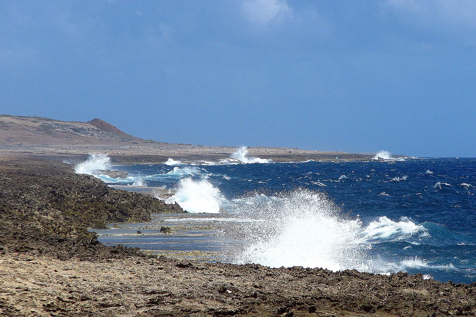
Shete Boka on the rugged north coast is where the sea slams into lava rock cliffs, forming blowholes and inlets. You do not need to hike far to get wow views.
-
Low-effort options:
- Drive into the park and follow the internal dirt roads (usually passable in a regular car if driven slowly and in dry conditions).
- From the main parking areas, a 5–15 minute walk on marked paths takes you to viewpoints over the inlets and blowholes.
- Surfaces are rocky, uneven and hot; wear closed shoes and bring water.
-
Parking realities:
- Official parking is by the entrance and at designated spots near the bokas.
- Don’t try to drive onto unmarked tracks; some head into rough terrain or turtle nesting areas.
- Lock the car and don’t leave bags visible.
-
Timing tip:
- Midday light is harsh but the sea is always impressive.
- If you start your loop early, this is a good late-morning stop; late afternoon works too, but check closing times in advance as these change.
After Shete Boka, you can either:
- Drop south briefly to one of the calmer west coast beaches for a swim, or
- Continue the rugged theme by riding the north coast a little further before cutting back toward the central road.
Drive Segment 4: West Coast Detours – Cliffs & Coves
From the park area, signs point to several west side beaches and coves. Choose 1–2 to keep the day relaxed rather than racing between all of them.
Westpunt Edge & Lookouts
Best for: Cliff views, sunset potential, short coastal strolls
At the island’s far west, the land rises above the sea, and several points give sweeping views over turquoise water and rocky coastline.
-
What to do with minimal effort:
- Pull into official beach car parks or marked viewpoints and simply walk to the edge of the cliffs on established paths.
- Spend 10–20 minutes just watching the coastline, especially where you can see both the calm south and rougher north.
- If you like, add one very short trail or staircase down to a smaller swimming cove.
-
Parking realities:
- Stick to formal parking lots; informal roadside parking near blind curves is risky.
- Some beach lots are unpaved with potholes — drive slowly and avoid deep holes after rain.
- Attendants sometimes keep an eye on cars; if someone offers “protection” services, it’s your call, but don’t leave obvious valuables either way.
Drive Segment 5: Salt Flats & Flamingo Views
Start driving back east, taking the coastal route where possible. You’ll pass salt flats and sheltered inland bays.
Jan Kok / St. Willibrordus Salt Flats Area
Best for: Flamingo viewing, sunset photos, no-sweat scenery
The shallow salt pans in this area often attract flamingos and other wading birds, especially when water levels are suitable.
-
Low-effort stop:
- Park in the obvious roadside pull-offs facing the salt pans.
- Stay by your car or walk a few steps to the edge to look for flamingos. Bring binoculars; the birds are usually some distance away.
- Move slowly and avoid loud noise; it’s a fragile feeding area.
-
Parking realities:
- Parking is informal but intuitive: where everyone else pulled off.
- Don’t drive onto the salt flats or muddy shoulders; it’s easy to get stuck or damage the habitat.
- Late afternoon can get busy; be patient about finding a safe space.
From here, continue along the coastal road back toward the urban area, or cut inland if you prefer faster driving.
Drive Segment 6: Coastal Views Back Toward Willemstad
Coastal Bluffs & Roadside Sea Views (Bullenbaai to Town)
Best for: Quick car-window scenery, pull-over photos
As you re-approach the Willemstad area, you’ll have several points where the road sits near the sea or on low bluffs.
-
What to do:
- Use any proper lay-by or small roadside lot to pull over briefly and capture a few last photos.
- This is more of a “rolling panorama” than a specific attraction — enjoy the changing colors and wind-bent trees as you drive.
-
Parking realities:
- Many apparent “spots” are actually just wider shoulder; make sure you’re fully off the lane and visible from both directions.
- Avoid stopping immediately after bends or hill crests; locals know the blind spots and will overtake.
You’ll soon merge back into heavier traffic closer to town; switch gears mentally from scenic mode to city driving.
Optional Short Walk Add-Ons
If you discover you have extra time or want more movement without a full hike:
- Short inland hill walks: Look for signposted trails near some of the old plantations between Tera Kòrá and Barber. Many are 30–60 minute up-and-back routes, but surfaces are rocky and shade is limited.
- Mangrove or lagoon edges: Around some of the inland bays on the south side there are simple boardwalks or flat paths where you can stroll for 15–30 minutes and return to the car.
Ask your accommodation or a local tourism office for a current simple trail map; new routes open and close over time.
Good to know
-
Navigation:
- Major junctions are signposted with village or beach names rather than route numbers.
- Locals often use landmarks instead of street names; using a pin on your map app helps.
-
Driving style:
- Expect speed changes as you pass through villages; speed bumps appear with little warning.
- Watch for scooters and cyclists using the edge of the road, and for goats or stray dogs in rural sections.
-
Fuel & cash:
- Fill up before you leave the Willemstad area, or top up again in Barber if you’re unsure.
- Many small snack places are cash-only; don’t rely on cards outside towns.
-
Heat & sun:
- Even short walks in the middle of the day can feel intense. Carry water in the car and use sun protection.
- Car interiors get extremely hot; don’t leave electronics or chocolate on the seats.
-
Safety & belongings:
- Petty theft from cars can happen. Keep things out of sight, lock the doors, and try not to leave bags in obviously unattended vehicles at remote spots.
- If something feels too isolated to you, trust that feeling and move on.
FAQ
Is it safe to drive this loop in a regular rental car?
Yes, if you stick to the main paved roads and the usual park access tracks in good weather, a standard small rental car is fine. Avoid deep potholes, muddy trails after rain, and any unmarked off-road tracks along the north coast.
How long does this scenic loop take?
Plan at least a full day if you want to stop for viewpoints, snacks, a short walk or two and maybe a quick swim. In pure driving time without stops it’s a few hours, but the whole point is to go slowly and enjoy the scenery.
Do I need a guide for Shete Boka and the viewpoints?
You can visit Shete Boka and the main roadside viewpoints independently; paths are short and clearly visible. A guide is useful if you want deeper geology and nature context or if you’re nervous about driving unfamiliar roads, but it’s not essential.
Can I rely on phone navigation around the island?
Phone apps work well on the main roads and in most villages, but signal can drop briefly in some rural pockets. Download offline maps before you go and always read actual road signs so you don’t blindly follow a wrong turn.
What’s the best time of day to do this drive?
Starting in the morning lets you see the north coast and salt flats before the light gets too harsh, and you can end on the west side for a sunset look. Avoid being on unfamiliar rural roads late at night when lighting is poor and animals sometimes wander onto the pavement.
Prices and opening times change. Always check current details before you go.
The weekly Curaçao letter
One short email a week: what's on, a useful guide and an insider tip. Free, unsubscribe anytime.
🎁 Free when you subscribe: the First-timer's Curaçao Checklist (PDF).
Getting around
Getting Around Curaçao Without a Car
How to get around Curaçao without driving: taxis, buses, shuttles, tours and the best areas to stay car-free, with honest local-style tips.
Getting from Curaçao Airport to Your Hotel
How to get from Curaçao’s airport to your hotel: taxis, private transfers, rental cars and shuttles, plus realistic tips for late arrivals and luggage.
Driving in Curaçao: rules, parking & common mistakes
A practical guide to driving in Curaçao: road rules, roundabouts, parking, gas stations and the most common mistakes visitors make, explained simply.